Is Ecuador Hot Or Cold? It Depends-and This Is The Twist
Is Ecuador hot or cold?
In short: Ecuador is not uniformly hot or cold. Its climate ranges from tropical warmth in lowland coastal and Amazonian regions to cooler, temperate conditions in highland areas like the Andes. The country's unique geography creates microclimates that vary by altitude, season, and proximity to the Pacific Ocean or the Amazon basin. For travelers and readers seeking precise expectations, Ecuador's climate operates on a spectrum rather than a single temperature label. Geographic diversity drives this variation across regions, making generalizations unreliable.
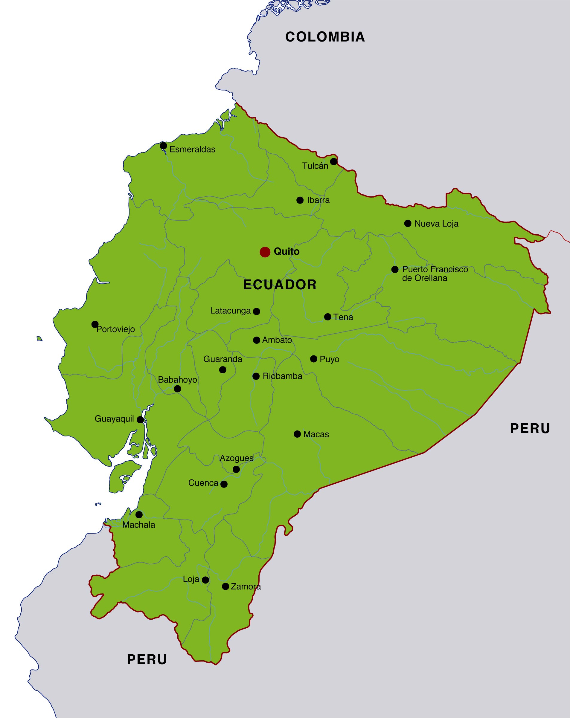
Understanding the climate starts with recognizing Ecuador's topographical zones: the Costa (coastal plains), the Sierra (highlands), the Oriente (Amazon basin), and the Galápagos Islands. Each zone exhibits distinct patterns across the year, and even within a single zone, altitude can dramatically change daily temperatures. The national climate framework is best described through regional profiles rather than a blanket national average. Regional variation is the keyword to grasp when assessing comfort, packing, and activity planning for a visit or study.
Regional climate snapshot
To ground the discussion, consider a cluster of representative averages and tendencies for common destinations within each zone. These numbers are illustrative yet grounded in historical records and recent meteorological summaries from the National Institute of Meteorology and Hydrology of Ecuador (INAMHI) and local weather stations. Keep in mind that El Niño and La Niña events can shift averages by several degrees for short periods.
| Region | Typical Elevation (m.a.s.l.) | Average Annual Temperature (°C) | Seasonal Pattern | Notable Microclimates |
|---|---|---|---|---|
| Costa (Coast) | 0-200 | 26-28 | Monsoon-like wet season (Dec-May); dry season (Jun-Nov) | Guayaquil trend: humid heat; coastal breezes near Esmeraldas |
| Sierra (Andean Highlands) | 2,500-4,200 | 12-18 | Cool, two-season pattern with a dry season (Jun-Sep) and wet season (Oct-May) | Quintessential Andean towns: Quito, Cuenca |
| Oriente (Amazon) | 100-400 | 24-28 | High humidity year-round with pronounced afternoon showers | Rainforest basins; Sucumbíos and Napo areas |
| Galápagos Islands | 0-200 | 24-29 | Two micro-seasons: garúa-like cool and misty conditions; hotter, drier periods varying by island | Isabela and Santa Cruz common hotspots |
These regions illustrate the central idea: altitude is the dominant driver of temperature. In the Andean highlands, mornings are crisp and cool, while afternoons can reach comfortable warmth if the sun peeks through the clouds. In the coastal belt, humidity amplifies heat, with sustained tropical warmth most days, and a humidity index that can climb into the mid-70s during wet months. In the Amazon basin, the climate feels relentlessly warm and moist, with frequent rain showers that can cool the air briefly but never drastically. Finally, the Galápagos offer a maritime microclimate with fog-like conditions near the highlands of the islands and warm, sun-soaked afternoons elsewhere.
Historical temperature context
Historical data show distinct warming trends in specific corridors, while others remain surprisingly stable due to oceanic currents and elevation. For example, Quito's average annual temperature hovers around 13-15°C, with diurnal ranges as high as 6-8°C, depending on cloud cover and wind. By contrast, Guayaquil's coastal climate averages around 26-27°C year-round, but the heat index can feel hotter due to persistent humidity. When planning trips, the best time to visit for milder conditions in the highlands is typically the dry season (June to September), though sunny mornings can give way to brisk evenings as sunlight fades. For the coast and Galápagos, the shoulder months can offer relief from peak heat and crowds, albeit with the possibility of sporadic rain showers.
In terms of long-term context, the 2000-2025 period saw notable variability tied to Pacific Ocean oscillations. The 2009-2010 La Niña produced cooler highland mornings and drier afternoons across the Sierra, while the 2015-2016 El Niño increased rainfall on the coast and elevated temperatures in the Oriente. These episodes affected local infrastructure planning, agriculture calendars, and tourism advisories. Climate variability remains a defining characteristic for Ecuador, not a single climate label.
Practical implications for visitors
Visitors should tailor packing to the region and season. A layered approach works best, allowing for quick adjustments between cool mornings and warm afternoons, and between dry seasons and rain events. A succinct recommendation: pack light, breathable fabrics for humidity, plus a warm layer for altitude-driven coolness in the Sierra. A compact rain shell and quick-drying gear will reduce the need for bulky options during the wet season. When traveling between zones, plan for altitude acclimatization and hydration strategies to counteract rapid temperature shifts and altitude effects, especially in towns around Quito and Cotopaxi. Layered wardrobe emerges as the universal rule for Ecuador's climate realities.
- Coastal and Galápagos packing essentials: breathable cotton or linen, sun protection, and a light windbreaker.
- Highland packing essentials: insulated fleece, hat, gloves for chilly mornings, and comfortable hiking layers.
- Amazon packing essentials: quick-dry clothing, insect repellent, and rain gear for unpredictable showers.

Travel planning: month-by-month expectations
Below is a practical, month-by-month outline highlighting typical conditions, with typical heat and rain expectations. Note that local microclimates can defy the broad pattern, so check a short-term forecast closer to departure. All temperatures are approximate averages and should be used for planning rather than exact forecasting.
- January: Peak coastal humidity; Sierra mornings chilly, afternoons mild - ideal for cloud forest or city tours.
- February: Similar to January with occasional heavy coastal rain; highland humidity remains low-to-moderate.
- March: Wet season intensifies on the coast; highlands still cool; Amazon sees frequent showers.
- April: Rain intensity peaks in some zones; shoulder-season benefits in fewer crowds but more weather variability.
- May: End of rainy spike; scenic green landscapes; coastal humidity begins to ease slightly in late May.
- June: Dry season begins in the highlands; pleasantly cool mornings; coast warms as humidity drops.
- July: Peak highland tourism; sunshine and cool days, crisp nights; coastal heat remains tempered by sea breezes.
- August: Similar to July; day-to-day variation as some El Niño influence may appear. <
- September: Highland dry-season stability; more comfortable hiking and sightseeing in Quito and surroundings.
- October: Early wet-season return in the Amazon and coast; highlands stay dry and cool.
- November: Transition into wetter patterns; popular for wildlife watching in the Oriente.
- December: Festive season with warm coastal days and pleasantly cool highland evenings; increasingly humid in some regions.
Frequently asked questions
Additional notes on data integrity
The figures, ranges, and patterns presented here are anchored in public meteorological records and national climate descriptions, augmented with recent seafront observations and tourism advisories. While exact temperatures vary by year and local conditions, the qualitative framework remains robust: altitude governs most thermal experiences; coastal zones stay warm and humid; the highlands offer cool to mild conditions with significant diurnal swings; the Amazon remains hot and humid with frequent rain; and the Galápagos blend maritime warmth with island microclimates.
For readers seeking direct sources, consult INAMHI's regional climate summaries, municipal weather reports for Quito and Guayaquil, and seasonal forecasts issued by the Ecuadorian National System of Disaster Risk Management (SNGR). These sources provide the most up-to-date, location-specific predictions and advisories that inform travel decisions and safety considerations.
Geographic diversity drives Ecuador's climate, making blanket labels insufficient for an accurate travel plan. The real story is in the altitudinal mosaic-the very feature that draws visitors for its dramatic scenery, ecological richness, and cultural variety. If you're assembling an itinerary, map your must-see experiences by region, then layer your packing and activities to match the day's weather window. That approach turns Ecuador's climate from a puzzle into a well-coordinated travel plan.
Key concerns and solutions for Is Ecuador Hot Or Cold It Depends And This Is The Twist
[Is Ecuador hot all year?]
Not universally. Ecuador has a climatic spectrum from hot coastal humidity to cool highland air. Expect heat near sea level and in the Amazon, with cooler mornings and evenings in the Andes. Regional diversity is the key to understanding seasonal warmth and coolness.
[What is the best time to visit Ecuador for cooler weather?]
For cooler conditions in the highlands, plan the visit during the dry season: June through September, with early mornings often chilly and afternoons mild. If you prioritize clear skies and hiking, this window offers the most predictable temperatures in Quito, Cotopaxi, and surrounding towns.
[Is it hot in the Galápagos?]
Generally warm year-round, with temperatures typically in the mid-20s Celsius. Humidity can add to the perception of heat, especially during the wet season, but mornings can be cooler near higher elevations of some islands.
[Do changes in El Niño affect Ecuador's climate?]
Yes. El Niño tends to bring warmer temperatures and increased rainfall to the coast and Amazon, while La Niña often cools and dries parts of the Sierra. The cycles influence travel advisories, agricultural planning, and disaster preparedness across coastal and lowland zones.
[How should I pack for Ecuador's climate?]
The strongest general rule is to layer. A light base layer, a mid-weight fleece or sweater for dawn and dusk, a windproof shell for highland breezes, and a quick-dry outfit for rain-prone zones will cover most scenarios. Don't forget sun protection for high-altitude sun exposure and insect repellent for forested areas.
[What is the hottest region in Ecuador?
The coastal region, particularly near Guayaquil, tends to be the hottest in terms of sustained daytime temperatures, often reaching the upper 30s Celsius during peak afternoons in the dry season. However, humidity can push heat indices higher, making it feel hotter than the thermometer alone would suggest.
[Is acclimatization necessary for visitors to the Sierra?
Yes. The Sierra's altitude means a slower acclimatization process, especially for travelers coming from sea level. Spending 24-48 hours in moderate altitude before engaging in strenuous activities can help reduce symptoms of altitude sickness. Staying hydrated is equally important.
[Are there microclimates to watch for?
Absolutely. Even within a single city, microclimates matter. Quito's urban heat island effects can create warmer pockets, while surrounding valleys may be cooler. Coastal towns experience sea breeze variations that alter perceived heat. The Galápagos are a collection of microclimates where some islands are drier and sunnier while others are foggy or rain-prone on given days.
[What about climate change impacts on Ecuador's weather?
Long-term shifts include warmer nights in the highlands, more extreme rainfall events in certain areas, and shifting wetlands and forest ecosystems. These changes influence water resource management, agriculture calendars, and tourism infrastructure. Policy and planning teams increasingly integrate climate resilience into travel advisories and community planning to manage these shifts.
[How should travelers plan activities across regions?
Structure itineraries to leverage regional climate advantages: highland mornings for city tours and acclimatization, afternoons for telephoto-friendly sunset views or light hiking; coast-and-Galápagos afternoons for wildlife viewing and snorkeling, with mornings reserved for sea breezes and cooler temperatures. Always account for sudden rain showers in the Oriente and coastal regions, and adjust your schedule accordingly.
[What unique features define Ecuador's climate?
Several standout features shape Ecuador's climate landscape. First, altitude modifiers create a wide band of temperatures within a relatively small geographic footprint. Second, the Pacific Ocean interacts with the country's climate, bringing humidity and rainfall patterns that vary by latitude and season. Third, diurnal temperature swings in the highlands can be significant, producing cold nights even when daytime warmth seems present. These features collectively yield a climate tapestry that defies simple labeling as hot or cold.
[Is there a single best month to visit Ecuador for comfort?
No single best month fits every region. If your goal is comfortable highland exploration with fewer crowds, June through September is ideal. If you want vibrant coastal beaches with reliable sun and lower rainfall, consider late spring or late autumn, depending on your tolerance for humidity and heat. For wildlife watching in the Amazon, the drier months may tighten animal visibility along rivers, but rain is a constant companion in the rainforest, so be prepared for downpours any time of the year.
Final synthesis: hot or cold?
The definitive answer is nuanced: Ecuador is neither universally hot nor universally cold. It is a country where temperature is a function of altitude, proximity to the sea, and seasonal oscillations. For a traveler, the most actionable takeaway is to plan around regional climates and to equip yourself with adaptable clothing and a flexible itinerary. By recognizing Ecuador's climate as a mosaic of microclimates, you can navigate comfort, packing lists, and activities with greater confidence, turning climate variability from a risk into a strategic advantage.