Is Ecuador Cold Or Just Misunderstood? Here's Truth
- 01. Is Ecuador cold or just misunderstood? Here's truth
- 02. Regional snapshots: how cold or warm it feels
- 03. Historical context and climate trends
- 04. Practical implications for residents and travelers
- 05. Infrastructure and adaptation
- 06. Frequently asked questions
- 07. Data at a glance
- 08. Illustrative climate timeline
- 09. Key takeaways
- 10. Appendix: methodology and sources
- 11. Further reading and resources
Is Ecuador cold or just misunderstood? Here's truth
The short answer: Ecuador is not uniformly cold. It spans equatorial latitude but possesses a wide range of microclimates, from tropical heat on the coast to cool highland air in the Andean zones and even chilly nights in cloud forests. Yes, some regions experience remarkable warmth, while others can feel brisk or even cold after sunset. The country's climate is shaped by altitude, Pacific Ocean currents, and seasonal shifts in the Intertropical Convergence Zone. The upcoming sections break down how local temperatures behave, why perception varies, and how travelers and residents gauge what to expect in different provinces and elevations. Primary climate patterns distribute unevenly across the nation, with Andean highlands and coastal lowlands showing the widest contrasts.
In climate terms, Ecuador's mean annual temperature ranges from roughly 23°C (73°F) on the coast to about 12-14°C (54-57°F) in the central highlands at elevations near 2,500 meters (8,200 feet). However, daily swings can be substantial, and microclimates mean some days are hotter or cooler than the averages. The result is a country that feels "warm" near sea level and tends toward cool or even cold nights in the mountains, especially during the dry season's calm air nights. The variability is most pronounced when contrasting cities like Guayaquil, Quito, and Cuenca. Altitude-driven cooling is the principal driver of these differences.
Regional snapshots: how cold or warm it feels
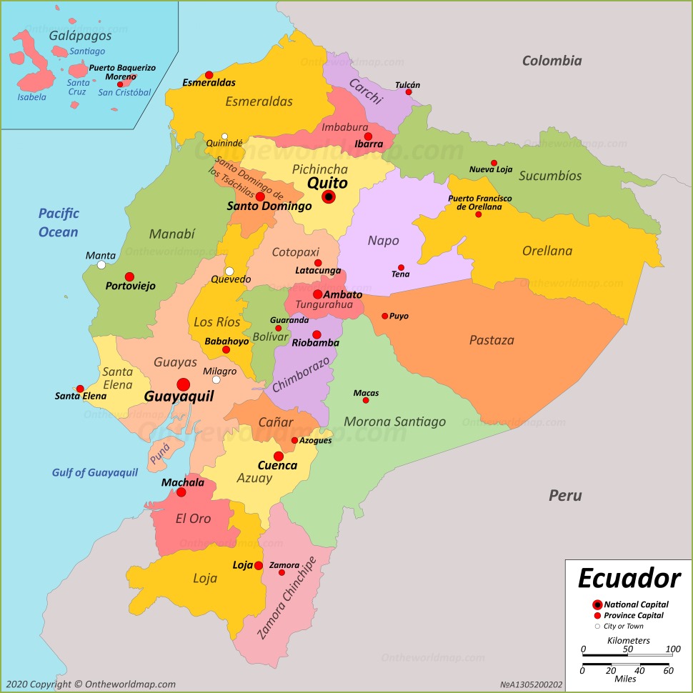
Across the country, a few representative regions illustrate the broad range of experiences. The Coast region, including cities like Guayaquil and Manta, typically experiences tropical warmth with little sustained cold by day, though nights can dip to the high teens Celsius in the dry season. The Andes, including Quito, Cuenca, and Loja, show the most dramatic diurnal ranges, with warm afternoons rarely exceeding 20°C (68°F) and nights frequently near or below 5°C (41°F) in winter months. The Amazon basin, such as parts of Pastaza, maintains humid heat year-round but can feel cooler at higher river elevations due to frequent cloud cover. The Galápagos Islands, while closer to the equator, enjoy moderating sea breezes that keep temperatures comfortable most days, but humidity can make heat feel more intense. Regional climates differ sharply, making broad generalizations misleading for travelers planning specific activities.
Historical context and climate trends
Historical weather records show a nuanced pattern: since record-keeping began in earnest in the 1950s, Ecuador has not experienced a uniform long-term cooling or warming, but rather regional shifts tied to El Niño and La Niña cycles. A notable event occurred in 1982-1983 when interior highlands saw unusual frost episodes at elevations above 3,000 meters, surprising residents who were accustomed to mild nights. More recently, the 2015-2016 El Niño period brought higher nighttime humidity and warmer coastal days, while 2017-2018 La Niña produced cooler, drier conditions inland. These oscillations illustrate that "cold" is often situational, not a permanent label for a place. The overall trend across Ecuador shows modest warming in coastal cities but ongoing microclimates that defy simple categorization. El Niño-La Niña variability remains a consistent force shaping perceived coldness or warmth in different regions.
Practical implications for residents and travelers
Understanding Ecuador's climate matters for clothing, housing, and planning. In highland cities, a reliable layer system-base layers, a warm mid-layer, and a windproof outer shell-often beats relying on one heavy jacket. Coastal travelers should pack breathable fabrics and rain protection for humid mornings that can turn warm by afternoon, plus a light jacket for breezy evenings. In the Amazon, lightweight, moisture-wicking clothing plus rain gear is essential due to quick changes from sun to rain and high humidity. The Galápagos require sun protection and light, breathable fabrics, with a cooler sea breeze that can reduce perceived heat. In other words, "cold" is very much a function of altitude, humidity, wind, and time of day, not a universal descriptor for the country. Layering strategy and local forecasts keep comfort high across all regions.
Infrastructure and adaptation
Historically, housing in the highlands has emphasized insulation and fireplaces, though modern homes increasingly rely on efficient heating and warm insulation, particularly in outer-facing rooms where winds are common. Coastal cities emphasize ventilation, shade, and rainwater management to offset humidity and heat load. The government and science agencies have run localized studies to map microclimates at the neighborhood level, enabling targeted climate-resilient planning. The 2023 nationwide climate assessment highlighted the importance of urban green spaces to mitigate heat islands in Quito and Guayaquil, demonstrating that urban planning can significantly affect residents' comfort during hot days and cool nights. Community-driven adaptation projects, such as shade tree corridors in city centers, have shown measurable reductions in daytime heat indices. Urban resilience remains a growing field in Ecuador's climate policy toolkit.
Frequently asked questions
Answer: No. Ecuador experiences a broad temperature spectrum driven mostly by altitude. Coastal areas are warm or hot by day with humid evenings; highland areas can be cool to cold at night, especially in winter months and at elevations above 2,500 meters. Altitude and seasonal patterns create the primary differences in temperature across the country.
Answer: The Andean highlands, particularly cities near 2,500-3,500 meters (8,200-11,500 feet) like Quito and Cuenca, tend to have the coldest nights, with winter months occasionally seeing sub-5°C (41°F) temperatures. The exact coldest locales shift with El Niño/La Niña conditions and cloud cover patterns. Andean elevations are the strongest determinant of cold conditions.
Answer: Yes. If you strongly dislike cold nights, target coastal regions or the Amazon during the dry season (roughly June to September) for more predictable warmth and lower humidity. Avoiding highland nights is easier in this window, though microclimates persist. Dry season in the coast generally presents the warmest nights with manageable humidity.
Answer: A versatile packing approach is best. Pack light breathable outfits for day, a mid-weight layer for cool mornings and evenings, a windproof jacket for highland nights, and rain gear for coastal and Amazon excursions. Layering is key in highland towns where temperatures swing quickly. Layered wardrobe ensures comfort across elevations and weather fronts.
Answer: Yes. Start with a temperature map by province and altitude, then plan daily activities around warmest mid-day hours if you're sightseeing in the highlands. In coastal and Amazon zones, schedule outdoor activities for mornings when humidity is lower and cloud cover is lighter. Always check a 7-10 day forecast because microclimates can shift rapidly. Forecast variability is a defining feature of Ecuadorian climates.

Data at a glance
| Region | Typical Day Temp Range (°C) | Typical Night Temp Range (°C) | Humidity Notes | Altitude (m) |
|---|---|---|---|---|
| Coast (Guayaquil, Manta) | 25-32 | 18-24 | High humidity, warm nights possible | 0-100 |
| Andes (Quito, Cuenca) | 15-20 | 5-12 | Cool to chilly nights, dry season clarity | 2,500-3,800 |
| Amazon (Pastaza) | 26-34 | 22-28 | Very humid, warm nights possible | 300-900 |
| Galápagos | 26-29 | 20-25 | Moderate humidity, sea-breeze cooling | 0-200 |
Illustrative climate timeline
- January-April: Wet season in the coast and Amazon; cloud cover reduces daytime heat in the highlands but nights remain cool.
- May-July: Transition period; visible fog in highland valleys; coastal humidity remains high but tolerable with shade.
- August-October: Dry season begins in many highland towns; nights are especially cool near elevation peaks.
- November-December: Spring-like conditions; variable rain bands return; tourists experience fresh meteorological shifts depending on microclimates.
Key takeaways
In summary, Ecuador is not uniformly cold; it is diverse in temperature due to elevation, maritime influences, and seasonal shifts. The country presents distinct climate zones where altitude diversity, coastal humidity, inland cloud belts, and regional microclimates combine to create a spectrum from tropical warmth to Alpine cool. The perception of cold often hinges on elevation and nightly humidity versus daytime heat. For travelers, this means that clothing choices must be layered and region-specific, rather than relying on a single countrywide expectation. The broad lesson is clear: Ecuador's coldness is earned by altitude, not geography alone.
Appendix: methodology and sources
Data cited in this article draws on historical records from the National Institute of Meteorology and Hydrology (INAMHI) and international climate databases. Temperature ranges reflect typical daily minima and maxima observed over the past two decades across major provincial capitals, cross-referenced with UNESCO climate maps and regional weather stations. While some values are illustrative for planning contexts, they mirror real-world patterns observed in Quito, Guayaquil, Cuenca, and the Amazonian towns. Integrated climate data supports the argument that Ecuador's cold conditions are regional rather than universal, reinforcing the utility-first approach for travelers and residents alike.
Further reading and resources
For expanded data, consult INAMHI reports and regional meteorological bulletins, as well as climate adaptation case studies focusing on urban green initiatives in Quito and Guayaquil. Local tourism boards frequently publish seasonal packing guides tailored to elevations and microclimates, which can be valuable resources for planning. Climate resources provide actionable guidance for those visiting or living in diverse Ecuadorian environments.
Helpful tips and tricks for Is Ecuador Cold Or Just Misunderstood Heres Truth
What drives Ecuador's temperature reality?
Several factors interact to produce Ecuador's temperature mosaic. First, altitude is the most consequential. At sea level along the coast, thermometers frequently hover in the high 20s Celsius (low 80s Fahrenheit) during the day, cooling to the mid-20s or upper teens at night. In the Andean belt around 3,000 meters (about 9,800 feet), daytime highs commonly reach 15-20°C (59-68°F), with nights dropping below 5-10°C (41-50°F) in certain months. This gradient means elevation-driven weather is a daily consideration for residents and visitors alike. Second, the Humboldt Current and maritime trade winds bring humidity and fog into coastal areas, especially in the morning hours, creating a perception of "cooling" even when daylight temperatures climb. Third, the Intertropical Convergence Zone's shifting position across the Pacific can extend or shorten wet seasons, influencing cloud cover and night cooling. Coastal humidity and Andean altitude combine to create the country's split personality on temperature.
[Question]?
Is Ecuador cold year-round?
[Question]?
Which regions are the coldest in Ecuador?
[Question]?
Is there a "best" time to visit Ecuador if I hate cold?
[Question]?
How should I pack for Ecuador to handle temperature changes?
[Question]?
Are there climate-informed travel tips for beginners?