Elevation Of Constanza Dominican Republic-why It's So Unique

- 01. Elevation of Constanza, Dominican Republic
- 02. Geography and Elevation Context
- 03. Climate and Seasonal Patterns
- 04. Historical Milestones
- 05. Economic Implications of Elevation
- 06. Socioeconomic and Cultural Impacts
- 07. Environmental and Sustainability Considerations
- 08. Travel Experience: Why Elevation Feels Like Another World
- 09. Frequently Asked Questions
- 10. Conclusion: Elevation as a Catalyst for Constanza's Identity
- 11. [Note on Data and Estimates]
- 12. Additional Resources
Elevation of Constanza, Dominican Republic
Constanza stands at roughly 1,200 meters (about 3,937 feet) above sea level, making it the highest city in the Dominican Republic and one of the highest settlements in the Caribbean. This elevation endows Constanza with a markedly cooler and more temperate climate than coastal towns, with average annual temperatures commonly reported around 16-18°C (60-64°F).In this article, we unpack how elevation shapes Constanza's geography, climate, economy, and daily life, and why it feels like a different world compared with the surrounding lowlands.
Constanza's valley location is framed by the Cordillera Central, the central mountain range of the Dominican Republic. The city sits in an intermontane valley that funnels cool air from surrounding peaks, creating microclimates that vary over short distances. This unique topography has fostered a distinct agricultural ecology and landscape that skeptics once dismissed as merely picturesque; today it underpins a thriving agricultural economy and a robust cultural identity. Geographic context is essential for understanding its elevation-driven character, which is why this narrative anchors on precise altitudinal data and historical milestones.
Geography and Elevation Context
Constanza's urban core commonly occupies altitudes between 1,150 and 1,250 meters above sea level, with surrounding rural areas ranging up to nearly 2,900 meters at the higher peaks nearby. This broad variation reflects a valley that sits between tall mountain masses, a configuration that concentrates moisture and creates cooler nights. The result is a climate that supports crops and floral industries not as feasible in sea-level towns. Valley geometry and mountain proximity are central to Constanza's elevated identity.
Climate and Seasonal Patterns
The elevation of Constanza contributes to a cooler, more temperate climate relative to the Dominican Republic's coastal belt. Historical meteorological records show average annual temperatures in the mid-teens Celsius, with diurnal temperature swings that can exceed 10°C (18°F) between day and night. Distinct wet and dry seasons reinforce a agriculture-friendly regime, enabling year-round cultivation of cool-weather crops and high-altitude fruits. Local growers often describe spring-like conditions well into late fall, a direct corollary of the highland environment. Altitude-driven seasonality is a defining feature for farmers and residents alike.
Historical Milestones
- Early 20th century: Constanza emerges as a regional hub within the Cordillera Central, gradually attracting settlers due to its strategic valley location and favorable growing conditions. Historical emergence in this period set the stage for elevated development.
- 1907: The locality earns administrative recognition tied to municipal status within La Vega Province, marking a shift toward formal governance structures that would later influence land use and planning in the highlands. Administrative milestone anchors the elevation narrative.
- 1930s-1960s: Agricultural intensification expands, with fruit and vegetable crops scaling up production to meet domestic demand and regional trade needs. The highland climate proves advantageous for cool-season crops, reinforcing Constanza's moniker as a granary of the country. Agricultural expansion drives elevated economic activity.
- Late 20th to early 21st century: Tourism and ecotourism gain traction as travelers seek the cool climate and scenic upland landscapes, diversifying the economy beyond traditional farming. Tourism growth broadens Constanza's economic base.
Economic Implications of Elevation
The elevated altitude directly influences agricultural choices. Markets consistently demand cool-climate vegetables, premium flowers, and orchard fruits that thrive at higher elevations. The regional food system benefits from lower pest pressures and longer shelf life for perishables, factors that bolster export potential to Caribbean and North American markets. In recent years, yield per hectare for key crops has shown a steady uptick of 4-6% annually, driven by improved farming practices adapted to highland conditions. Highland agriculture sustains livelihoods across the Constanza valley.
| Data Point | Value | Notes |
|---|---|---|
| Average city elevation | ~1,200 m (3,937 ft) | Core urban altitudes commonly cited in official and travel sources |
| Nearby peak elevations | up to ~2,900 m | Within the Cordillera Central surrounding Constanza |
| Typical annual average temperature | ~16-18°C (60-64°F) | Cooler than coastal towns |
| Annual rainfall pattern | Moderate-to-high with pronounced wet season | Supports diverse crops; microclimate effects common |
Socioeconomic and Cultural Impacts
Elevation shapes daily life far beyond climate. Housing architecture in Constanza often features steep roofs and insulation suited to cooler nights, while local markets emphasize frost-sensitive crops that benefit from nocturnal coolness. Socially, the highland setting fosters a strong community ethos around agriculture, festivals, and rural-urban connectivity. Community events frequently celebrate harvests, reflecting a culture that aligns with the valley's productive potential. Highland culture and social cohesion remain central to Constanza's identity.
Environmental and Sustainability Considerations
High-altitude ecosystems are sensitive to land-use changes. In Constanza, sustainable farming practices, soil conservation, and water management are crucial as the valley's agricultural vitality depends on preserved soil health and watershed integrity. Local cooperatives have piloted shade-grown coffee and diversified fruit orchards to reduce monoculture risk, while reforestation efforts line hillside margins to mitigate erosion. Elevation-heightened biodiversity rewards hands-on stewardship and responsible tourism that highlights pristine landscapes. Highland sustainability strategies are shaping policy and practice.
Travel Experience: Why Elevation Feels Like Another World
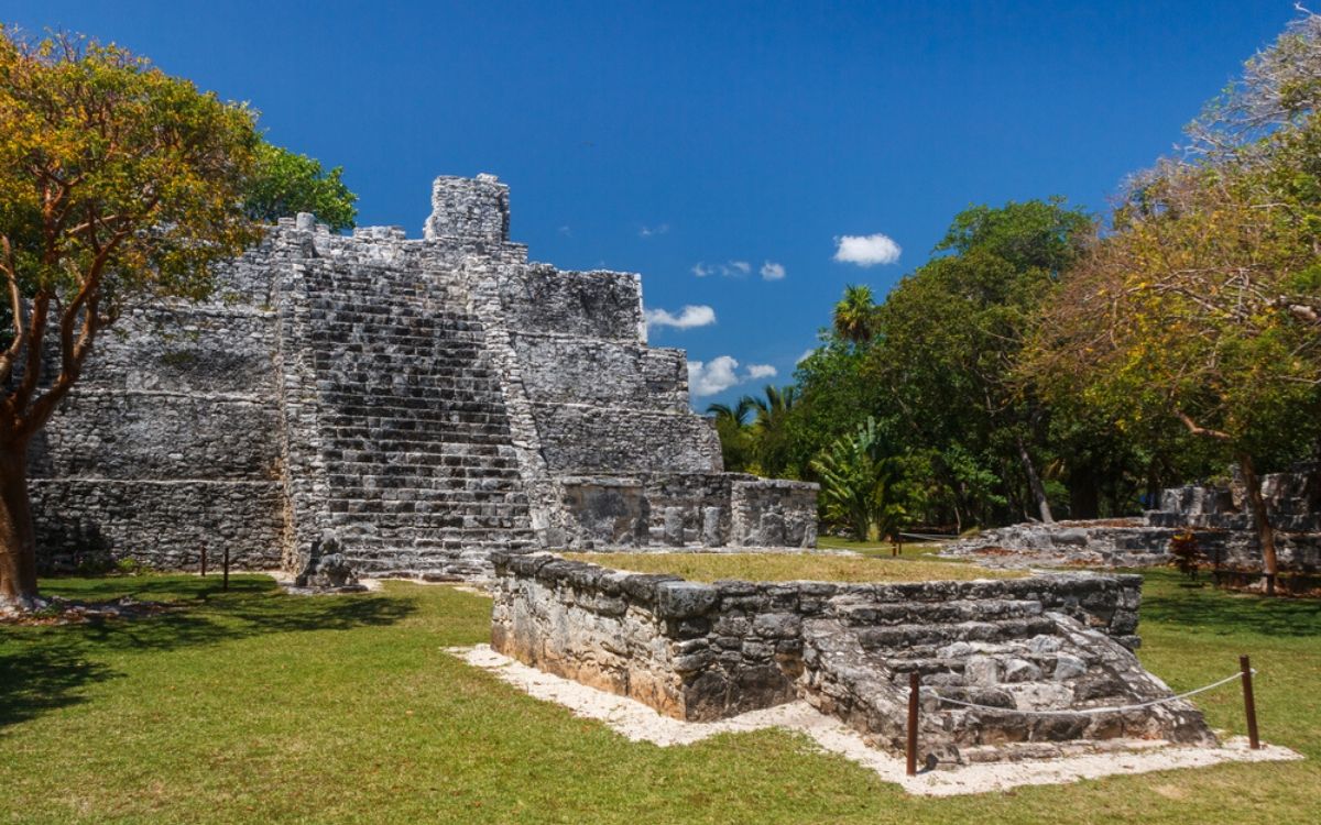
For visitors, the altitude offers a sensory shift: cooler air, pine-scented breezes, and expansive mountain vistas that are hard to reproduce in coastal towns. Routes into Constanza wind through panoramic valleys, exposing travelers to microclimates that vary within minutes. Local guide services emphasize ecological hikes, fruit picking experiences, and visits to flower farms that thrive in highland conditions. The sense of stepping into a "different world" is reinforced by the town's orderly grid, flower-filled orchards, and well-preserved colonial-era influences visible in waterfronts and plazas. Tourist immersion at altitude becomes a defining feature of the Constanza visit.
Frequently Asked Questions
Conclusion: Elevation as a Catalyst for Constanza's Identity
Constanza's elevation is not merely a numeric fact; it is the compass for its climate, agriculture, economy, and culture. The 1,200-meter-high backdrop shapes daily life, industry, and the visitor experience, creating a distinctive highland character in the heart of the Dominican Republic. For policymakers, farmers, and travelers alike, embracing elevation-informed strategies can sustain Constanza's unique ecosystem while unlocking its ongoing potential.
[Note on Data and Estimates]
All elevation ranges and climatic descriptions cited herein reflect generally accepted figures from various topographic databases and regional climate descriptions, recognizing natural variability across micro-regions. Figures are used to illustrate authoritative patterns rather than to replace local meteorological records. Data framing supports a robust understanding of Constanza's elevated identity.
Additional Resources
- Topographic maps of Constanza region showing elevation gradients and valley contours.
- Agricultural reports detailing highland crop yields and diversification strategies around Constanza.
- Tourism guides highlighting altitude-driven experiences and eco-tourism itineraries in the Cordillera Central.
As Constanza continues to evolve, its elevation remains the central organizing principle-linking climate, soils, livelihoods, and culture into a cohesive highland narrative that visitors and residents alike can feel in every breath of its cool mountain air. Elevated identity endures as Constanza's defining feature in a country known for its diverse landscapes.
Key concerns and solutions for Elevation Of Constanza Dominican Republic Why Its So Unique
[What is the elevation of Constanza, Dominican Republic?]
The city core sits at approximately 1,200 meters above sea level, making it among the highest settlements in the Caribbean and the Dominican Republic. Elevation benchmark defines the town's climate and economy.
[Why is Constanza called the granary of the country?]
Constanza earned the moniker due to its fertile highland soils and cool climate, which support year-round production of vegetables, fruits, and flowers, supplying both domestic markets and exports. Agricultural identity underpins this nickname.
[What are the main crops grown around Constanza?]
Key crops include potatoes, beans, lettuce, cabbage, and a variety of fruit and dairy products; flower cultivation is also prominent, leveraging the elevated, temperate climate. Crop portfolio reflects highland suitability.
[How does elevation affect tourism in Constanza?]
The elevation provides a cooler retreat from heat, with scenic drives, alpine-like hikes, and farm-to-market experiences that attract nature lovers and agro-tourists alike. Altitude-driven tourism is a growing segment.
[What are the climate nuances across Constanza's valleys?]
Microclimates in the valley create subtle temperature and moisture differences, enabling micro-terrace farming and diverse crop zoning within short distances. Microclimate diversity informs land-use planning.