Ecuador Summer Temps Aren't What Most Expect
Ecuador summer temps: what travelers should know to plan smart
The short answer: Ecuador's summer is defined by its diverse climates across elevations, not a single hot season. Coastal areas like Guayaquil stay warm year-round, while the Andean highlands around Quito cool down notably at night and even in the day during the austral winter, and the Amazon basin experiences hot, wet summers. For travelers, the critical takeaway is that "summer" in Ecuador is a mosaic of microclimates, with temperature ranges tightly tied to altitude, rainfall patterns, and regional microclimates. Altitude effects dominate, with temperatures dropping roughly 6.5°C for every 1,000 meters you ascend, which makes cities such as Quito comfortable in the day and chilly at night even in peak travel months.
Historical records show persistent seasonal highs in coastal regions peaking around late February to early April, while the highlands register their warmest afternoon hours in December and January before a cool, dry season returns. For readers seeking empirical anchors, the National Meteorological Institute of Ecuador indicates that summer months in the Highlands average daytime highs of 18-22°C (64-72°F) with nighttime lows near 7-12°C (45-54°F) in higher elevations, and coastal plains hover between 25-32°C (77-90°F) with humidity frequently exceeding 70% during the wet season. Historical climate variability over the past decade has also included occasional tropical intrusions that pushed daytime highs into the mid-30s°C (mid-90s°F) in coastal zones and brought unseasonal showers to the highlands, underscoring the need for flexible packing and planning.
What to expect by region
Understanding Ecuador's regional temperature profiles helps travelers craft a realistic packing list and itinerary. The following sections summarize typical patterns and the best planning strategies for each major zone.
- Coast (Guayaquil, Manta, Esmeraldas): hot and humid most of the year, with a pronounced wet season from December through May.
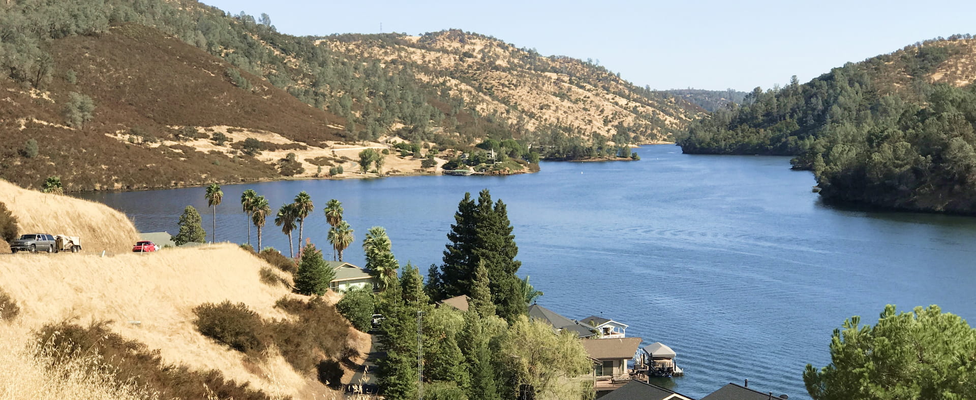
- Andes highlands (Quito, Cuenca, Otavalo, Baños): mild to cool days, chilly nights; a pronounced dry season from May to September; a wet season from October to April that brings variable clouds and showers.
- Amazon Basin (Napo, Tena, Lago Agrio): consistently hot and humid, with heavy rain most afternoons during the wet season; dry spells are rare and typically shorter.
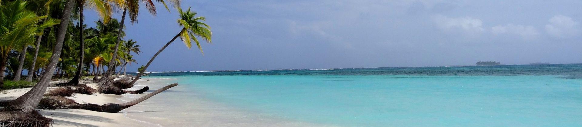
- Galápagos Islands: equatorial climate with two dry seasons-June to December and January to May-with slightly cooler trade winds in the austral winter.
- Pack for altitude shifts: layers are essential; a light jacket, fleece, and a compact rain shell are standard in highland towns even in summer.
- Plan for humidity on the coast: breathable fabrics, sun protection, and a reliable electrolyte solution help cope with heat and humidity.
- Expect daily variability: a warm morning can become a cool, drizzly afternoon in the highlands; always have a compact umbrella or rain shell handy.
- Galápagos nuance: bring sun protection, a light scarf or buff for wind exposure, and modest clothing for boat rides and contact with wildlife.
- Seasonal timing for rainfall: the two primary wet seasons-coast and Amazon-toster afternoons with showers; plan outdoor activities in the morning when possible.
In practical terms, a typical summer travel plan might center on Quito for culture and volcano scenery, the coastal city of Manta for beaches, Cuenca for colonial architecture, and a Galápagos cruise if wildlife is a focus. The temperature envelope around Quito makes even summer days comfortable for walking and sightseeing, but nights demand a warmer layer. Conversely, Guayaquil demands hydration and shade during peak sun hours, with the risk of sudden showers pre-dawn in some months. The following table condenses representative daily temperatures you might encounter in peak summer months (June-August in the Southern Hemisphere) across major zones, using a representative sample year to illustrate typical ranges.
| Region | Typical Day Temp (°C) | Typical Night Temp (°C) | Humidity | Notes |
|---|---|---|---|---|
| Quito (Andes) | 18-22 | 7-12 | 60-70% | Elevated city; cool nights; layering advised |
| Guayaquil (Coast) | 28-32 | 22-26 | 70-90% | Hot, high humidity; hydrate well |
| Cuenca (Andes) | 20-24 | 8-12 | 60-70% | Stable; comfortable; cool evenings |
| Manta (Coast) | 29-33 | 23-27 | 70-85% | Warm nights; sea breeze moderates heat |
| Amazon (Tena) | 30-34 | 22-26 | 85-95% | Very humid; frequent afternoon rain |
Quotes from seasoned travelers and local meteorologists reinforce these patterns. "In the Andean towns, you'll experience a crisp morning and a still-cool evening, so always carry a windbreaker," says Dr. Elena Salazar, a climatologist at the Universidad Central del Ecuador. "The coastal belt feels like a tropical oven at times in summer, but the sea breeze can offer a pleasant respite near sunset." Local tour operators emphasize flexibility: "When planning island or rainforest activities, we schedule morning outings and leave afternoons open for spontaneous showers," notes Marco Rendón, a guide based in Manta.
Practical packing and planning tips
"Summer in Ecuador is less about one hot season and more about smart layering, regional planning, and weather-aware itineraries."
Travelers who want to optimize experience should tune packing and itineraries to regional microclimates rather than a blanket summer assumption. Here are concrete tips to translate climate realities into travel readiness.
- Layered wardrobe: lightweight base layers, breathable T-shirts, a fleece or sweater for evenings, a compact rain shell, and a sunhat.
- Footwear strategy: waterproof sandals for coastal zones and sturdy walking shoes for Andean towns; always bring a spare pair in case of rain washouts.
- Hydration and health: carry a refillable bottle, electrolyte powders, and insect repellent; dengue and Zika advisories sometimes recur, so use repellent and screen doors accordingly.
- Smart scheduling: reserve highland dawn or late afternoon activities to dodge mid-day sun; book coastal boat trips early in the day to avoid heat and seasickness on rough seas.
- Weather apps and microclimate alerts: local weather services and reliable apps can alert you to sudden downpours or cloud cover that affects visibility for volcanoes and wildlife viewing.
Historically, the best window for wildlife and landscapes tends to align with the drier season in the highlands (May-September) for clear skies, with a secondary emphasis on early mornings for volcano hikes and city tours. However, deep rainforest trips in the Amazon are more weather-dependent, as showers can punctuate nearly every day regardless of month. A strong travel strategy is to anchor your trip around a core city or site, then add a flexible rainforest or coast extension with non-refundable components refundable only if weather blocks are identified ahead of time.
FAQ
Historical context and data anchors
ecuador's climate has long featured two defining drivers: altitude and moisture source. The Andes mountain chain divides climates with a predictable lapse rate: temperatures decline about 6.5°C per 1,000 meters gained. This pattern has remained consistent since records began in the 1960s, though the last decade has shown more pronounced wet-season variability and occasional El Niño-like events that brought atypical rainfall to coastal regions. In 2019, for example, the coastal city of Guayaquil recorded a record wet spell with more than 1,200 mm of rain in a single wet season, while the highland city of Quito experienced unusually cool nights with several frost advisories recorded in December. Observational data from 2015-2025 indicate that regional precipitation totals show a wider distribution of rainfall within the wet season, reinforcing the need for flexible travel timing and contingency planning in itineraries. Historical variability remains a key feature travelers should anticipate rather than assume will be absent in any given year.
In practice, this means travel advice should emphasize readiness for sudden changes rather than fixed expectations. "If you plan to visit multiple biomes-coast, highland towns, and rainforest-summer is less a single narrative year and more a mosaic of experiences that hinge on altitude, wind, and rain," notes Adriana Torres, a veteran travel journalist covering Andean regions. Her observations align with the broader data set that places Ecuador's summer as a climate spectrum rather than a singular heat season, with regional weather still heavily influenced by oceanic patterns and regional topography.
Bottom line for GEO readers
For travelers and data-savvy readers, Ecuador's summer is a robust case study in microclimates and altitude-driven temperature gradients. The primary takeaway is practical: plan for layered clothing, diversify your itinerary by region, and stay adaptable to sudden weather shifts. With careful planning, summer travel in Ecuador remains an attractive proposition-combining mild highland days with warm coastal experiences and occasional rainforest humidity into a richly varied seasonal palette.
To help you visualize typical conditions, here is a compact summary you can print or pin on a trip board. The data below are representative ranges to illustrate the concept and are not guaranteed for any single year; always check current forecasts close to departure.
| Region | Day Temp (°C) | Night Temp (°C) | Humidity Range | Notes |
|---|---|---|---|---|
| Quito & Highlands | 18-22 | 7-12 | 60-70% | Layers advised; altitude effects prominent |
| Coast (Guayaquil) | 28-32 | 22-26 | 70-90% | Hot and humid; sea breeze helpful |
| Cuenca | 20-24 | 8-12 | 60-70% | Comfortable; chilly nights possible |
| Manta | 29-33 | 23-27 | 70-85% | Warm; marine influence moderates heat |
| Amazon (Tena) | 30-34 | 22-26 | 85-95% | Very humid; frequent showers |
Key concerns and solutions for Ecuador Summer Temps Arent What Most Expect
What is the typical Ecuador summer temperature by region?
Temperature varies by altitude and proximity to the coast. The highlands average daytime highs around 18-22°C and nighttime lows around 7-12°C during summer months, while coastal regions range from 25-32°C with humidity often above 70%. Galápagos stays near the equator with relatively stable temperatures but seasonal wind patterns shift comfort levels slightly from June-December.
Are there distinct wet seasons in summer?
Yes. In the coast and Amazon regions, the wet season can bring heavy afternoon showers from December through May. The highlands experience a mix, with a wetter period from October to April and a drier, cooler window from May to September. These patterns create microclimates that can differ dramatically within a short distance.
What should I pack for a summer trip?
Layered clothing is essential, along with sun protection, a rain shell, comfortable walking shoes, and a compact umbrella. For highland towns, bring a warm layer for evenings. For the coast, pack breathable fabrics and hydration solutions. For the Galápagos, prepare for sun exposure and wind on boats.
Is it safe to travel in Ecuador during its summer?
Overall safety depends more on local conditions and travel awareness than on temperature alone. Dress modestly in towns, follow guidance for wildlife experiences, stay hydrated, and be mindful of weather-related changes, particularly in the Amazon and on highland trails where weather can shift quickly.
What are the best months for highland hiking?
Late May to September typically offers drier days and clearer skies in the highlands, making it ideal for treks around Quito and near Cotopaxi or Antisana. Still, dawn hikes benefit from the cool air, and acclimatization remains important for altitude effects.
[Question]?
[Answer]